Pages

Monday, August 8, 2011

The mountains are calling......

On the Blue Ridge Parkway near Meadows of Dan, VA
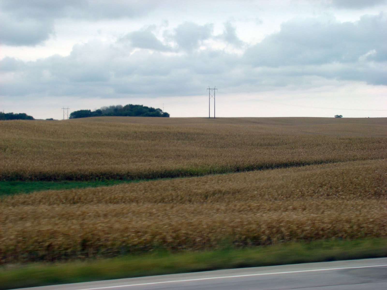
The peaks of the Blue Ridge Mountains stretch toward the heavens, with the dusty blue hue almost making them blend with the sky. As they seem to become one, the eyes must search to find where one ends and the other begins. The 469 mile Blue Ridge Parkway
straddles the peaks and valleys and affords travelers a view of the magnificence. The mountains, a part of the Appalachian Range, stretch from Georgia to Northern Pennsylvania alongside farmland, small towns and villages.

Small farms, tucked into the mountain valleys and hanging onto the mountainside, supply the farmer's markets, in the small towns. Signs proclaiming "locally grown" stand beside the baskets of bright red tomatoes, yellow and white peaches (still growing plentiful, in the mountains), apples, ears of sweet corn, and numerous other veggies . Occasionally, a field of tobacco reminds us that this area of the country is also known for their tobacco crops. 


Remnants of old buildings, guarded by split rail fences, still dot the landscape. Early settlers built their cabins by the rocky creek beds to have water for their families, their crops, and their livestock. Many stayed to farm and
raise their families in these mountains. The more adventurous continued westward, willing to endure the  hardships of early travel across the mountains, to open a new frontier.


In Rocky Knob National Park, a lush bed of green ferns - fit for any hanging basket - grows plentiful, under the tall stand of hardwood trees. The multitude of concrete picnic tables, scattered about the park, were being taken over by moss, indicating a lack of use by tourists. The paved roadway weaved its way through the park and crisscrossed with hiking trails, warning hikers to watch for bears. I complained to the Park Ranger that I hadn't seen the first bear, and she responded with "the only one I've seen crossed the road, in front of my car".  I would question the survival of this park during these hard economic times; for other than a peaceful drive through a mountain forest, or a quiet respite for weary travelers, it had little else to offer.

Just about a mile from the peaceful little village of Meadows of Dan (named for the Dan River) is Mabry Mill (photo shown above). The park, which includes a grist mill and blacksmith shop built in 1910, is now maintained by the National Park Service. Old farm tools, and wagons, placed about the park are reminiscent of how life was "in the old days". The blacksmith shop still functions, and Park Service Rangers give hourly demonstrations.


Off the Blue Ridge Parkway past Fancy Gap, VA, and into North Carolina, is Mount Airy. Famous as the birthplace of Andy Griffith, the town has really managed to capitalize on its famous son and Mayberry. There's the Mayberry Museum, Mayberry Theatre, Mayberry Souvenir Shops (where posters of Andy, Barney, Opie, and Aunt Bea are plentiful), Floyd's Barber Shop, and Opie's Candy Store, just to name a few.  If you're interested, Mayberry Tours will take you on a ride in one of the old black and white police cars. Now, my honey had the camera while I was in one of the Mayberry souvenir shops, buying my "collectible" magnet, so I didn't get to see the old black and white. (Only a true "take a picture of everything person" would think to grab and click when it passed by!)
                                                                                        
Not only is Mayberry famous for Andy,          
it's also famous for Snappy Lunch and
their "World Famous (in their words)
Pork Chop Sandwich". Opened in 1923,
in the same location, the diner gained
notoriety because of The Andy Griffith Show.


Cooked on a grill, behind the cash register, and visible from the sidewalk......the World Famous Pork Chop Sandwich is served, on a bun with cole slaw, tomato, onion, and chili! I just couldn't imagine eating chili on my Pork Chop, so I opted out of that selection.

It was good, and messy, but next time I think I'll just have my Pork Chop, with a biscuit!! And yes, it is boneless and more like a piece of pork tenderloin than a pork chop.


Back in Lake Ridge RV Park, just outside Hillsville, VA but within view of the beautiful Blue Ridge Mountains, we can almost hear the mountains calling to us.

The mountains are calling, and I must go. - John Muir


Friday, July 15, 2011

In the mountains.....beauty......and tragedy

At 5,729 feet, Mt. Rogers is the highest point in Virginia. Yesterday, it was our mission to get there, or as close as possible. There is no road, to the summit, so close meant "visually close". We left Hillsville, headed west on Hwy. 58, and soon saw a sign stating that Bristol,  VA was only 107 miles.  We discussed that this might be a new route (in our RV) when we started back home. After many miles of highway as "crooked as a dog's hind leg", with speed limit warnings of 15 mph, there were no more discussions of trying to navigate this road in a Motorhome!

Christmas Tree farms, with acres and acres of trees that seem to cling to the mountainside, dotted the landscape.


Looking east from Sugarland Overlook
in Grayson Highlands State Park, the
valley and, in the distance, the Blue
Ridge Mountains.

We stopped at Grayson Highlands State Park which borders Mount Rogers National Recreation Area on the south. There are 9 hiking trails in Grayson as well as access to almost 3 miles of the Appalachian Trail, which runs from Georgia to Maine. 78 miles of the Appalachian Trail lies within the Mount Rogers NRA and is only 1/2 mile from the summit of the mountain.


The Virginia Creeper Trail,  a 34 mile hiking - biking trail converted from the Norfolk and Western Railway roadbed also traverses the Mount Rogers National Recreation Area. The trail starts in Abingdon, Virginia and ends near the North Carolina state line.


Ever so often, an old settler's cabin .....from days long past......would appear.


From the beauty of the mountains, the church steeples with the mountains as their backdrops, the creek beside the highway rushing over the rocks.......we were suddenly back to reality. The tornadoes that struck our towns in Mississippi and Alabama, in April, had made their way to the mountains of Virginia. Trees had been splintered, as if they were match sticks. Houses had been blown apart and leveled. Semi-trailers had been crumpled, as if they were toys in the hands of a child.

On one side of the mountain.....beauty, and on the other.......tragedy. 


Thursday, July 14, 2011

With the Motorhome loaded and "road ready" we were both excited to get on the road, again. We left home early on Thursday July 7th (one week ago, today), headed for the mountains of Virginia,  near the Blue Ridge Parkway.  We met our friends, Sam & Ann Greco, at a Rest Area in Alabama and had our first (this trip) breakfast.

Our first night out, we stopped at beautiful DeSoto State Park just outside Fort Payne, Alabama. What a great place to camp........clean, well-lit with wide, asphalt pads under the trees, and cable tv! (Camping, at its best!). Hidden in the Alabama mountains, deep in the forest are canyons and waterfalls, beautful rock formations, hiking trails, and wildlife. As night fell, we were serenaded by cicadas, tree frogs, and somewhere in the distance, two owls called to each other across the mountain.


Fort Payne, AL Train Depot - restored
 How I would have loved to have time to wander the streets of Fort Payne, with its quaint little shops, antique stores, and the 'Alabama' museum. (My 'bucket list' just grows and grows!)  We left this beautiful park, with a promise (to ourselves) to return. How picturesque it would be, in the fall, with the mountainside bathed in shades of red, yellow, and orange.

We made our way through Chattanooga -  navigating Interstate 24, always busy, regardless of the hour. We stopped for fuel in Cleveland, TN and had our first real "irritation" of the trip. The station advertised diesel, at a pretty decent price (not as good as at home, but not bad). As we, and two other big rigs pulled into the station, everyone realized we could get in.......we just couldn't get out!! We unhooked our tow vehicle, and backed the RV out ...... but not before I entered the station and "suggested" to the clerk that they should post a warning "No Big Rigs". (He barely looked up from his newspaper.....I'm sure it wasn't the first, and won't be the last, complaint.)

We had driven under cloudy skies most of the day (a great shield from morning sun). Finally, about mid-afternoon the deluge came - slowing our travel down, considerably. With about 3 hours remaining on our trip, and our final destination in the mountains.....the decision was made to stop for a second night. We spent night number two at Rocky Top Campground near Bristol, TN. A great little RV park with such friendly hosts....too bad this wasn't our final stop!

We arrived at Lake Ridge RV Park, in southwestern Virginia near Hillsville (and there is a reason it was given that name!), about noon on Saturday. The Blue Ridge mountains, in the distance to our south and east, looked as if they had been dusted with blue powder, and then covered with a tent of dusty haze. The tall peaks rose, as if stretching for the sky and then dropped into deep valleys. I imagined dozens of hikers, heartier souls than I, climbing to the mountain tops and looking out over this valley in which we camp.

And then came the joy of trying to get our Motorhome into the reserved, tree shaded spot. (Long story - short - it didn't happen!) We unhooked our tow car, and I followed behind ..... up one hill and down another, as Bob and the RV followed the guide in the Golf Cart. In many RV parks, if it's necessary to back in.....a guide is there to assist. As the guide pointed out the spot, and Bob began to back up - I realized, as our RV exhaust and backend was digging into the dirt, the guide must have considered his job done. He remained in his Golf Cart....in front....oblivious to everything happening, in the back. I quickly parked and got out of the car.....yelling like a mad woman.  When he understood that our Motorhome wouldn't fit into the reserved spot, he decided that Bob needed to pull forward and continue down the road, to another spot. Thankfully, a bright young man came along and told him "that won't work ....there's a drop off up there!" (Obviously, this guide needs training.....bless his heart!)

We finally got parked, without assistance, but there are no trees to shade us. (And yes, I did comment that we could have stayed in our own yard if we were going to park, in the sun.) But, I was very gently reminded that we wouldn't have the Blue Ridge Mountains, as a backdrop. There are just some arguments a girl can't win!!

More adventures to follow.....


Thursday, July 7, 2011

The end of one journey, and the beginning of another.....

After a long trip home from northern Minnesota, just 40 miles from the Canadian border, we parked the RV in our yard on Saturday, September 25, 2010. After an injury to his back, while playing golf in North Carolina, Bob had driven with a heating pad at his back as well as frequent stops to lie on the sofa and rest. Little did we know that his back injury was just a precursor to what lay ahead and had little, or nothing, to do with golf!

The following week, we made several visits to our Primary Care Physician. A referral to an oncologist, on October 7, 2010, resulted in a diagnosis of Multiple Myeloma. Myeloma is an incurable cancer of the plasma cells in the bone marrow. The "ups and downs" of his illness is recorded on our blog  Our Journey With Multple Myeloma.

Bob has responded well to chemotherapy, and after six cycles has been able to take a break. We're back "on the road, again".  We recently enjoyed a trip to the Outer Banks of North Carolina, and are now getting our "rolling motel" ready for another trip to a campground in the beautiful mountains of Virginia - near the Blue Ridge Parkway.

I'm sure the cool, fresh mountain air will do wonders both physically and emotionally. Not too many months ago, we weren't sure he'd be able to take more trips, but the man is a survivor!!

Saturday, September 25, 2010

Wind Farms, Cornfields, and finally, the cottonfields back home........

Earlier in the week, we rode out of Minnesota and across into the farm lands of Iowa. Northern Iowa has become the Midwest Wind Farm Belt with hundreds of the tall, wind turbines dotted across the farmland. Development companies set up meterological towers that determine wind velocity, for one year, as well as to determine the placement of the turbines. Farmers are paid from $5,000 - $7,000 for one-quarter acre piece of land. Once the tubines are placed, the land can go back into cultivation. Each turbine is from 200 - 300 feet tall and can provide electricity for thousands of homes.
                                                                                            
The tall turbines tower over the trees.


       The clouds hung low, and the big arms turned rapidly in the wind. These turbines, sit in the middle of this northern Iowa cornfield.

    The fields, of Iowa corn stretched endlessly, along the Interstate, over the rolling hills.

     Iowa, where the tall corn grows, has been the top producer of corn for the past 14 years. 


        In Missouri, we saw our first cottonfield - reminding us of our own home state. 

As we head south out of Tennessee, down I-55 toward Jackson ....and home.....we see that some of our own hardwood trees have begun to lose their shades of green and have hues of gold and some red. The weather is warmer (much) than what we left behind. 

We'll be glad to park this vehicle in our own yard, for awhile. We hope you've enjoyed traveling with us, looking at the photos and have also learned a little history as we've gone along. How fortunate we are to live in this beautiful land........the USA.

Until next trip...................    

Sunday, September 19, 2010

The winds were howling yesterday, as usual, and the canopy on the RV looked as if it would blow away. Honey made an "Executive decision" to bring it down before Mother Nature took care of it, for us! Being the self-designated backseat driver, does not mean that my instructions are limited to a moving vehicle.....I find that I can instruct at any time! I think honey was actually glad to have my assistance - it's no mean feat to get the darned thing rolled back up, and locked in place, and with the wind blowing 90 to nothing, you almost wish you didn't have a canopy! And, had we not put it up .....we probably wouldn't have had one for long.

We decided to try another "Fall Color" drive, and I was hoping we might even see a Moose somewhere among the trees and underbrush. There are Moose crossing signs on almost every road, 'Moose viewing area signs', and Moose observation platforms ....but we've had no luck. We've seen every other wild animal, possible .....wolf, fox, deer, and black bear....all on a public highway, but no moose. I laughingly told honey maybe we should just go park on a highway, and wait for a moose to come along....since they don't seem to be where the signs say they are.

The Fall Color routes begin with paved roads, but the pavement ends very quickly, and one finds oneself on gravel or dirt. On this road, the branches of the trees seemed to reach out to one another and formed a beautiful canopy. And, scattered down these dirt roads were homes - most with firewood already stacked in place, ready for the winter.


Signs like these, warning of a 'Sled Dog Crossing' are frequent, along the backroads. There were trails thru the woods, with noticeable ruts, on either side of the road.
 This was probably the cutest sign we saw and was understandable, in any language!


Just across the Canadian border we saw several gaggles of geese, as if they were convening, in preparation for a flight south ....soon. (And, who could blame them!)


Had they been just a little larger, and the weather just a little warmer, these waves could have been a surfer's paradise!


The evening sunlight played on the waves, as they crashed against the rocky beach at Colville, Minnesota. This community was named for Colonel William Colville who led Minnesota troops, at Gettysburg, and returned to settle in the area. 

So much history, and so much beauty, in this beautiful land.....


Saturday, September 18, 2010

Yesterday, the rain finally stopped and Lake Superior looked like it was full of millions of glittering diamonds, as the sun bounced against the blue water. The wind seems to blow continuously, bending the trees and covering the ground with the leaves which are changing from green to shades of red and gold. 

We took a drive toward the highest point in Minnesota - Eagle Mountain - 2,301 feet and were awed by the beauty of the fall colors, covering the sides of the foothills.

The road signs directed us to the "Fall Color Tour"....and the picture above, taken from the car, corroborates the sign. The colors of the maples, interspersed with firs, were beautiful, and seem to be more vivid by the day.


Sky Lake, one of Minnesota's 10,000 lakes is dotted with houses, nestled in the trees and coves, around the shoreline. At times, in the snowy winters in this northland, the only mode of transportation is a snowmobile.


The Grand Marais Lighthouse, still active today, was built in 1885, and reconstructed several times - the last time in 1922. The base, unlike many lighthouses, is a steel structure. There was a lighthouse keeper until 1937 when the keeper retired, at age 71.

Today, we'll venture out to view more beautiful reds, of the Lake Superior maples. We've decided that we'll hit the road tomorrow, before more cold rain sets in. There's more to see, in this beautiful land.....